Kamloops is known for some pretty spectacular hiking trails. There are trails for every kind of hiker: nice and easy flat trails for an evening stroll, intermediate trails for those looking to get a cardio workout, and difficult trails for the more adventurous soul.
If you are visiting, these 13 Kamloops hikes are a great way to see the city from different viewpoints and take in the beautiful scenery from every angle. If you live in Kamloops, these hikes never get boring and can (and should) be done many times!
Where is Kamloops, BC?
Kamloops is a city in the province of British Columbia, Canada. It is approximately 2700 feet above sea level. It is where the North Thompson River and the South Thompson River meet, close to where they start. The city has a very diverse terrain, so there are many kinds of Kamloops hikes for every kind of hiker.
When Is the Best Time To Go on the Kamloops Hiking Trails?
The best time to go on these Kamloops hikes is any time of year! The late evenings in the summer are beautiful when the days are the longest. Weekends, late mornings, and early evenings can get busy with other hikers, so plan your time wisely.
The Kamloops area offers many opportunities for year-round outdoor activities. The long, dry summers allow for hiking and biking on a variety of trails that are not accessible during winter months when snow is more prevalent.
In the spring and autumn, hikers will find Kamloops trails with flowers blooming or leaves changing color.
What Should I Bring When I Do a Kamloops Hike?
If you are planning a Kamloops Hike, you will want to come prepared during the season you are hiking. Aside from water and snacks for your energy levels during the hike, it’s best to wear sturdy footwear with good treads.
Bring sunscreen for summer hikes or warm clothing if you’re going on an autumn hike. If you’re planning on hiking Kamloops after a rainfall, make sure you pack bug repellant.
13 Must-Do Kamloops Hikes with Views:
Battle Bluff Kamloops – Our Favourite Kamloops Hike!
This 4.8-kilometer hike is the most challenging trail on this list but rewards you with the most spectacular views at the top. The trail will take roughly 1.5 hours as it climbs through forest and grasslands to reach an open ridge with views across Kamloops Lake.
The Battle Bluff trail begins with an easy double track through the trees and then opens up to spectacular vistas as you progress closer to the summit.
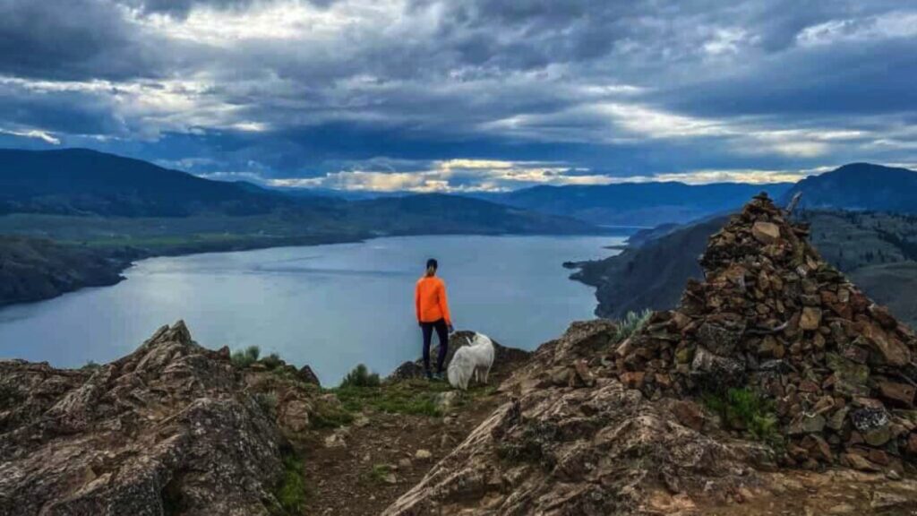
The trail is relatively moderate most of the way, but it does become a steep, rocky single track as it seesaws up to the summit. Most of the trail is exposed, so bring water, especially in the summer, and take your time if needed.
The trail is dog-friendly and can be done with kids, but make sure to keep them close when you arrive at the Bluffs because there are cliffs all around with steep drop-offs.
At the top of the summit, there is a book that hikers can sign. It gives a little history of the Battle Bluff trail.
The Tower Trail at Kenna Cartwright Park
The Tower Trail is an easy 3.4-kilometer hike that is perfect for families and can be accomplished by young children. The trail is dog-friendly, so feel free to bring your pooch along. This trail has a moderate incline to the lookout, so be prepared to take breaks if needed along the way.
It is completely exposed in the summer, so bring water for a more enjoyable experience.
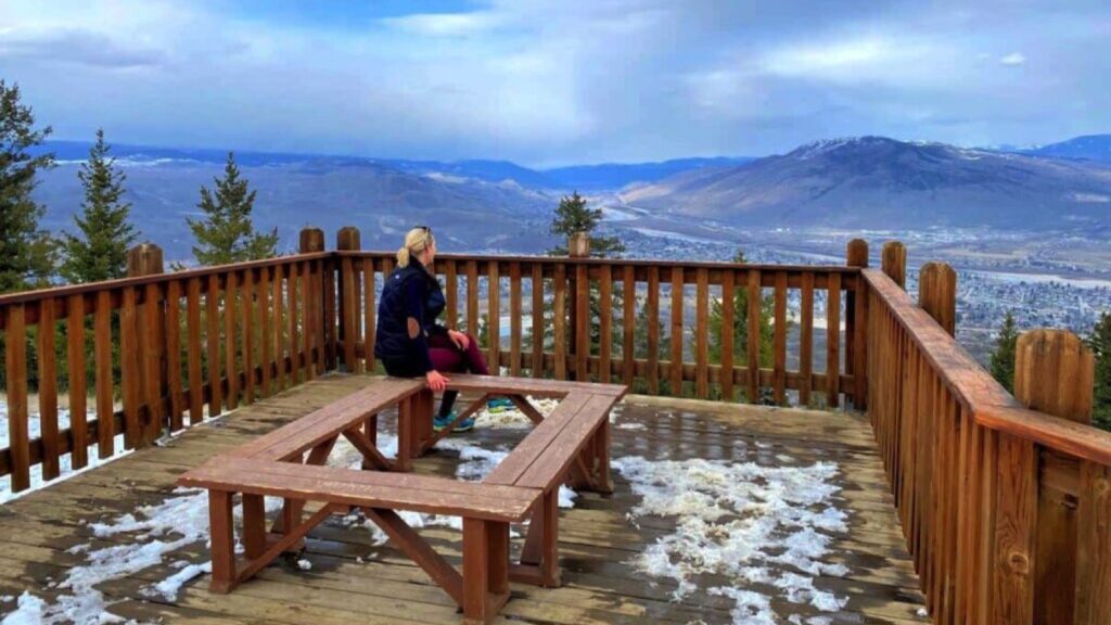
This Kamloops Hike offers amazing views from its high point, a series of hills known as “the towers.” The trail can be accessed from both the Home Depot park entrance and the Hillside Drive entrance just before the prison.
It has a great mix of steep climbs and more gradual slopes, so it’s perfect for hiking beginners looking to build their fitness skills while also seeing some fantastic scenery from different vantage points. The trail is quite popular in the summer, and many people use this Kamloops hike to get outdoors and enjoy the sunshine.
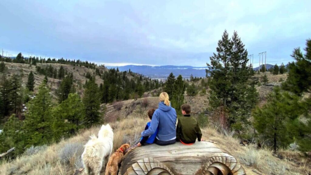
Panorama Loop
The Panorama Loop trail starts at the Kenna Cartwright Park entrance at the recycling center on Bunker Road. This 2.8-kilometre Kamloops hiking trail takes roughly 45 mins and offers views of Kamloops to the north, south, and east. The trail has no steep inclines, so it’s easy for everyone to enjoy this Kamloops hike.

When you enter the trail at the park entrance, follow the Sage Trail until you come across the intersection with the Panorama Loop.
As you start nearing the top of the trail, you will know you are close to the summit when you see the red and white pole. There is a bench to sit at the summit, a perfect opportunity to enjoy this vantage point above the city.
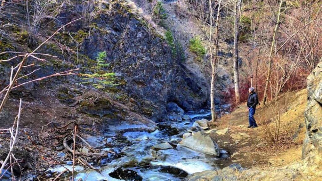
Bridal Veil Falls in Peterson Creek
Peterson Creek Park offers many different trails for all levels, with breathtaking viewpoints on the elevated trails. One of the most popular is the trail to Bridal Veil Falls, which is, for the most part, an easy 30-40-minute hike. However, the last part can get quite rugged and rocky, so you should be prepared to hike at your own risk.
Depending on the water levels, you may have to cross the creek to keep hiking to the falls, but keep your camera handy because there are some beautiful photo opportunities throughout the hike.
The entrance to the Xget’tem Trail is also in Peterson Creek. The City of Kamloops recently invested $2.7 million in addition to a $1 million grant from the Ministry of Transportation to build a 1.7-kilometer pathway from Sahali to downtown Kamloops. The Xget’tem Trail is complete with lighting and rest areas and provides a safe pathway for walkers and cyclists.
Cinnamon Ridge Hoodoos
Just a short drive northwest of Kamloops, the Cinnamon Ridge Hoodoos offer a striking landscape of eroded spires and ridgelines reminiscent of the American Southwest. These formations are the remnants of an ancient volcanic eruption approximately 50 million years ago, with iron-rich volcanic rocks weathering into the distinctive cinnamon-colored hues that give the ridge its name.
The trail begins with a steep ascent over loose clay and rocks, leading hikers into a dried creek bed that winds through slot-like canyons. This route is part of the Lac du Bois Grasslands Protected Area and is known for its challenging terrain, including steep, dry, and slippery sections. Proper footwear with a good grip is essential, and hiking poles are recommended for added stability.
Along the way, hikers are treated to panoramic views of the Thompson Valley, unique geological formations, and a variety of desert flora, including prickly pear cacti and sagebrush. The area is also home to diverse wildlife, such as birds of prey and, occasionally, California Bighorn Sheep.
From downtown Kamloops, head west on Tranquille Road past the airport and golf. Turn right onto Ord Road, cross the train tracks, and continue along the dirt road to the cul-de-sac at the end, where parking is available.
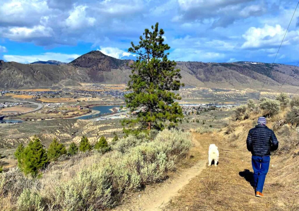
The Rim Loop at Valleyview Nature Park
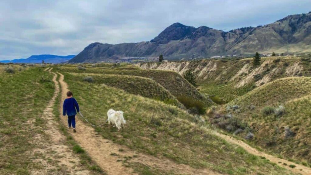
The Rim Loop Trail is a popular Kamloops hike that offers views of the city and lots of wildlife. The trail entrance is next to Valleyview Arena, and you must follow the Sagebrush trail that connects to the Rim Loop.
This 2.5-kilometer Kamloops hike is a loop that starts at the Valleyview Nature Park entrance and goes along the edge of the hoodoos overlooking the neighborhood of Valleyview. The middle of the trail offers beautiful views of the hoodoos surrounding Valleyview Nature Park. It is an off-leash area, so you will likely encounter many dogs while on this Kamloops hike.
If you are hiking this Kamloops trail with small children, be cautious when walking along the edge overlooking Valleyview, as the single-track trail gets very close to the cliff.
If you are nervous about heights, you can walk a little further away from the edge in some areas. It can also get quite windy up on the top of this Kamloops hike, so pack a light layer with you just in case.
Gibraltar Rock Hike at Paul Lake
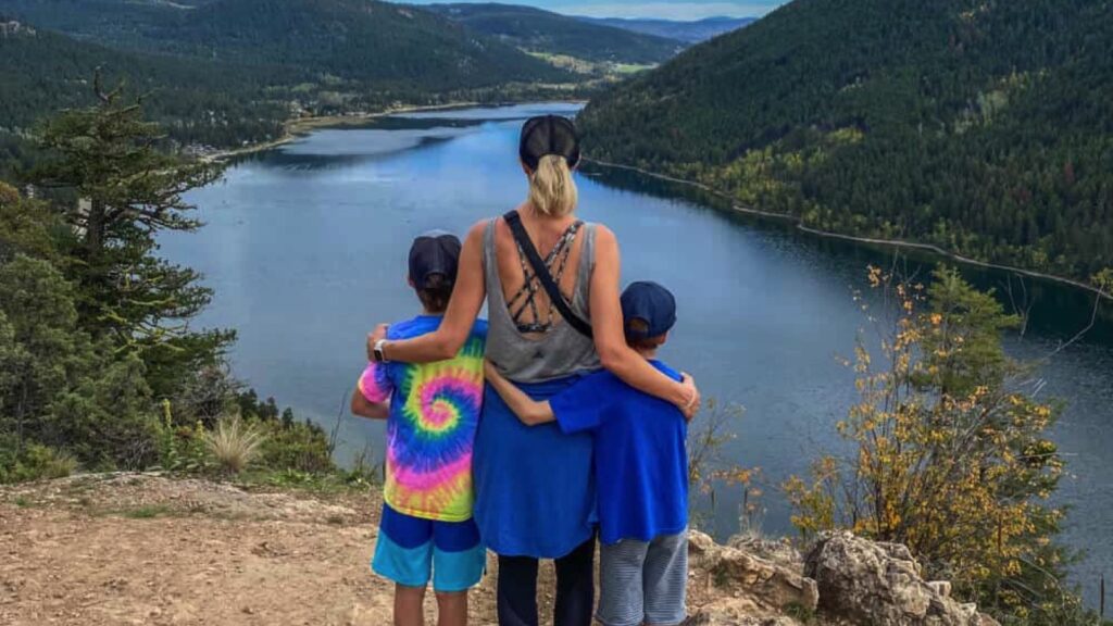
The twenty-minute drive from Kamloops to Paul Lake sets the stage for a glorious day of hiking. The beautiful rolling hills on the drive are part of this adventure. The trail begins just past the boat launch at Paul Lake Provincial Park.
If you want to park as close to the trail as possible, you will want to drive down to the boat launch. But I would suggest parking near the bathrooms and enjoying the short walk along the shore. It is a pretty area, with picnic tables lining the water’s edge.
The Gibraltar Rock hike is a 3 km round trip if you start from the boat launch and return the way you came in. The first 1 km is a steady incline until you reach a bench and fork in the road. Keep to the left and continue to the top of Gibraltar Rock.
The summit has multiple viewpoints and a couple of benches to sit on and enjoy the view. Keep young children close, as the trail’s edge is quite steep. The trail up to the top is a steady incline the entire way, but when you see those views, you will be glad you made an effort.
The Perimeter Trail at Rosehill Park
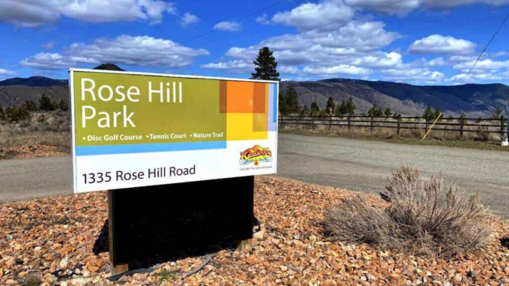
This 1.5-kilometer trail around the Kamloops Disc Golf Course is a straightforward hike with beautiful views of the Thompson Valley. This trail can be difficult to follow sometimes because of the many trails going off to launch pads for the Disc Golf Course, but as long as you stay to the main trail on the perimeter, you should have no trouble at all.
It is dog-friendly as long as dogs are leashed, and you will often see families enjoying the walk and the views. There is a beautiful viewpoint on the western side of the trail with a carved-out bench to take a rest and enjoy the scenery. Just make sure to keep your eyes out for frisbees!
Aviation Way – Rivers Trail
This Kamloops hike is the easiest on this list of hiking trails in Kamloops. The trail is flat and can be as long or as short as you would like. Aviation Way trail is a section of the Rivers Trail network, and the entrance is right next to the radar tower, where ample parking is available.
There is a washroom in the parking lot at the trail’s entrance. This is also a popular off-leash dog area, so you will see many four-legged friends along the way.
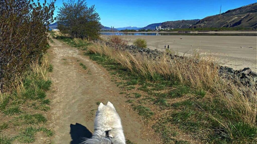
About one kilometer past the entrance, the double-track trail splits and allows you to continue walking along the berm or alongside the edge of the beach. During the early spring and fall, you can head out onto the beach while the river is low and explore by the water. The trail to the beach is lined with large rocks, but a couple of spots allow access down to the water without too much rock climbing.
Even though this Kamloops hike does not have an elevation change, it is surprisingly one of our favorites in the city. Many people dismiss this part of the city due to its proximity to the dump and the pulp mill, but in our opinion, this trail has so much to offer that it should most definitely be on your list of Kamloops hiking trails.
Juniper – Rosehill Ridge Trail
This trail has many options, and the shortest one is an easy 2-kilometer hike out along the ridge. You can enter this trail at the yellow gate from the S-curve on Rosehill Road, where there are cement barriers, and then take your first left onto a single-track trail to venture out to the ridge. Or you can remain on the wide double track that follows the pipeline all the way to Juniper.
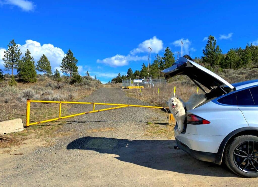
The single track along Rosehill Ridge provides stunning views of the valley and has a few inclines to get your heart rate pumping. If you follow the loop, it will link back to the double track along the pipeline. This trail is great for running and dog-friendly, but keep your eyes peeled for bears, as they regularly frequent the Rosehill neighborhood.
No matter which trail you pick in Kamloops, you will be rewarded with beautiful scenery and a memorable experience. If you want to live an outdoor lifestyle, Kamloops is the place to be, with endless opportunities and activities and beautiful sunshine all year.
Hiking Trails on the Outskirts of Kamloops
Painted Bluffs Provincial Park
Painted Bluffs is one of the most visually striking hikes near Kamloops, a rugged and remote landscape sculpted by volcanic activity and erosion. The multi-colored hills—rust red, chalky white, ochre, and slate blue—look more like something you’d find in Utah than the Thompson Valley. But they’re right here on the north side of Kamloops Lake.
There are no marked trails into the bluffs, and that’s part of the appeal. Reaching them often means hiking in on rough overland routes or paddling across the lake. Doug Smith, past president of the Kamloops Hiking Club, describes the area as “a unique geological area, accessed by a rugged trail.” This isn’t a stroll—it’s a challenging, off-trail experience best suited to seasoned hikers confident with route-finding and scrambling.
But the payoff? Total solitude and unforgettable views across Kamloops Lake. The exposed hillsides catch the light differently throughout the day, and the silence out here is vast. You won’t find signage or facilities—just the raw, mineral-rich textures of a place shaped over millennia. Painted Bluffs is one of those rare places where every step feels like discovery.
Pro tip: Visit in dry weather and wear sturdy footwear with good grip. The clay-rich soil can become dangerously slick when wet. This hike is best suited for summer and early fall.
Neskonlith Meadows
Just east of Chase, Neskonlith Meadows offers one of the most breathtaking spring wildflower displays in the southern Interior. This hike is a seasonal favorite for the Kamloops Hiking Club, and for good reason. Doug Smith, past president of the club, notes, “We have hiked Neskonlith Meadows, one of the best routes for the spring wildflower bloom.”
The trail begins with a steady ascent through open grasslands, leading to expansive meadows that are awash in late April and early May with vibrant hues of balsamroot, lupine, Indian paintbrush, and glacier lilies. The combination of rolling terrain and panoramic views of the Shuswap Highlands makes this hike both visually rewarding and moderately challenging.
For those seeking a longer adventure, the trail continues approximately 5 kilometers to Aylmer (Star) Lake, with a vertical gain of 256 meters (840 feet). This extension offers a peaceful lakeside setting, perfect for a mid-hike rest or picnic. The route follows an old double-track path, making navigation straightforward for most hikers.
Isobel Lake Interpretive Trails
Just a 40-minute drive northwest of downtown Kamloops, Isobel Lake offers a serene and accessible hiking experience suitable for all ages and abilities. The 3.2-kilometer loop trail encircles the tranquil lake, featuring well-maintained boardwalks, interpretive signage, and numerous rest areas. Designed with inclusivity in mind, the trail is wheelchair-friendly and ideal for families with strollers or individuals seeking a gentle outdoor excursion.
Educational interpretive signs along the path provide insights into the area’s local flora, fauna, and ecological significance, making it a popular destination for elementary school field trips and nature education programs. The trail’s thoughtful design includes accessible pit toilets, picnic tables, and benches, ensuring comfort and convenience for all visitors.
In the winter, the trail transforms into a picturesque snowshoeing route, offering a peaceful setting to enjoy the snow-covered landscape.